Localize Values
![]()
This command detects the location of the minimum and maximum intensity values of an inspected cloud or mesh. Moreover, it allows detecting iso gradient lines on an inspected mesh.
Select one inspected cloud or mesh and launch the command.
Inspected cloud
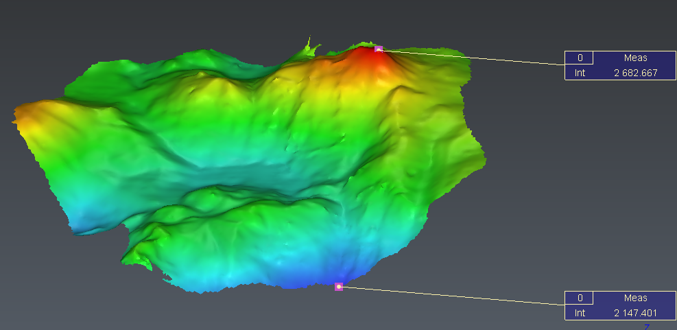
With a point cloud, the command computes min and/or max values of the inspection:
Extract min: the point(s) with the minimum of the gradient values
Extract max: the point(s) with the maximum of the gradient values
If there are several points/zones with the same min or max value, one point is created for each extremum point/zone.
Display labels allows to add some labels on the extracted points.
Inspected mesh
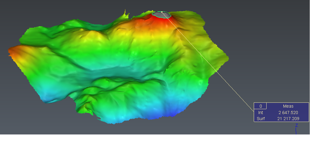
With a mesh, the command computes either min and/or max values of the inspection, or iso gradient lines.
Extract Min / Max: extract min and/or max values of the inspection. See the explanation in the section above.
Extract by threshold: extract isogradient lines
Threshold step: allows you to define a step between each isogradient line computed. The starting and ending values are defined:
All over: between the minimum and the maximum values of the gradient
From / to: in the range defined
Give a list of thresholds: allows you to specify each individual threshold you want to extract.
If you edit the gradient with the button Edit Color and set some intermediate levels, these levels will be put in the list of threshold by clicking on button Fill with gradient's level(s).
Mesh transparency: set the transparency of the mesh to view more or less the isolines.
Display labels allows adding some labels to the extracted points or isolines.
With isolines, the label displays the deviation and, if the line is closed, the surface inside the line.On isolines, the base point of the label is on the contour, without specific rule for the attachment point.
The minimum and maximum values are automatically computed when entering the command and each time you change the colors using Edit color button
Extract the minimum and the maximum point (based on altitude in this case)
Extract the area which is above the maximum value by lowering the maximum peg of the gradient