Exercise: Align a point cloud on a reference model according to the shape (Best Fit)
Open the file BestFitOnRef.3dr.
This file contains a cloud "Measured Dam" and a mesh "Theorical Dam (good CS)". We will see how to align the cloud on the mesh.
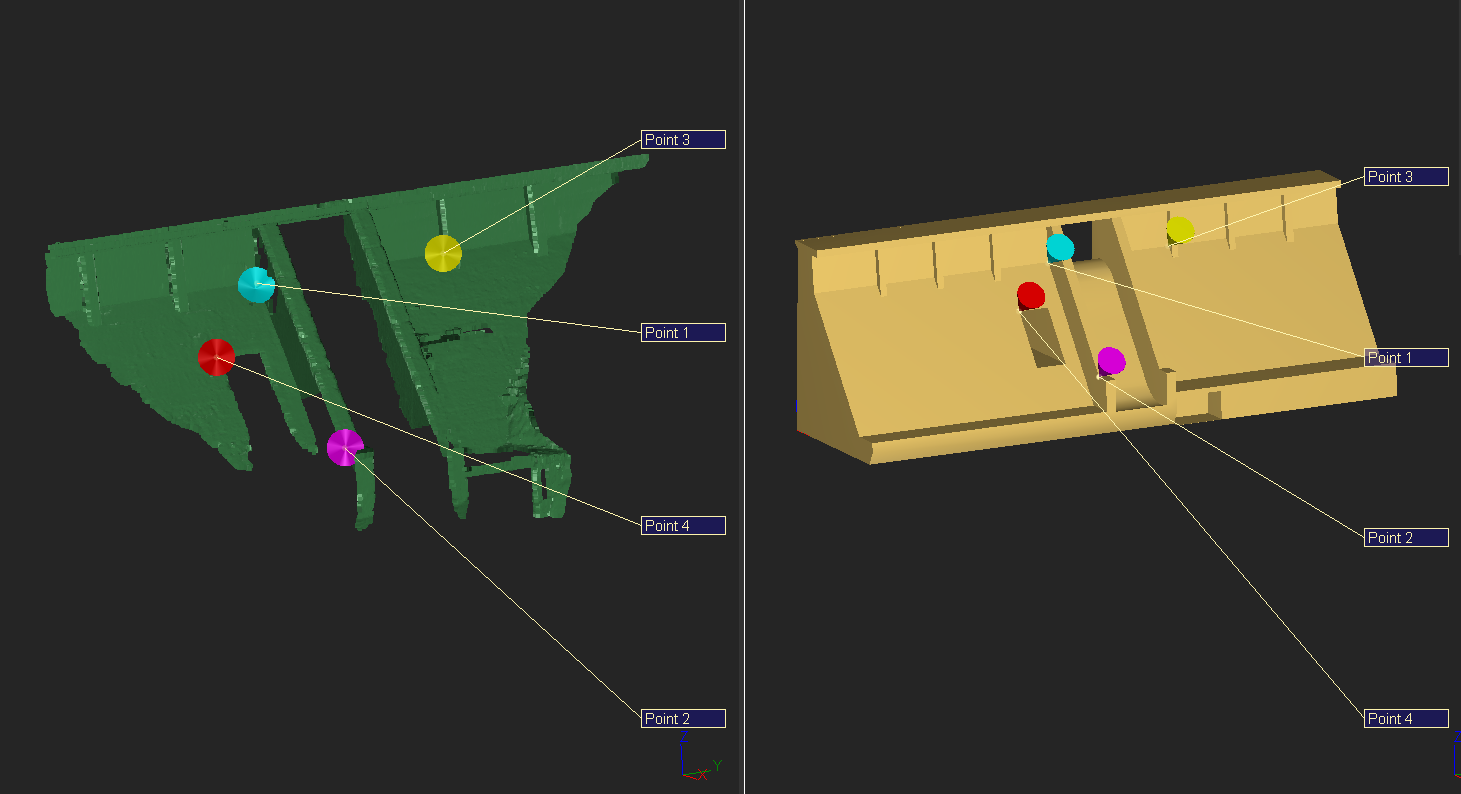
Show only these two objects. Select the point cloud only and launch the command N Points Registration.
 Enter points during the Best Align N Points command
The screen will be divided in two parts:
On the left, the selected objects, in this case the cloud "Measured Dam". All objects on the left will move.
On the right, the non-selected objects, in this case the mesh "Theorical Dam (good CS)". All objects on the right will not move.
Select the option Compute new alignment in the list. Then, enter couples of points in order to do a rough alignment by combining a point on the cloud and a point on the mesh. To realize this step, select the option Vertex End. First, click on a point on the cloud and then the corresponding point on the mesh. Click at least 3 couples of points (you can click on edges to make it easier). To have a good result, your points should not be aligned and all over the object (see Figure above).
Once you have entered your couples of points, check Apply Bestfit and click Preview. The software has now computed a best fit (using the rough manual alignment that you can check thanks to one label per couple of points that is also created in order to see deviations). Next to the dialog box a small report is displayed in order to summarize all the transformations.
If the result is not correct, press Delete twice to remove the last couples of points and enter a new couple of points. You can also Reset the computation and disable some pairs.
Note
You can define some constraints during this alignment. For example, if the Z axis is correct on the cloud, select the option Constraints rotation axis and then choose the option Z. It means that rotation around X and Y will be disabled.
Click OK to validate. The cloud is now in the reference coordinate system, and you can for example proceed to a comparison.
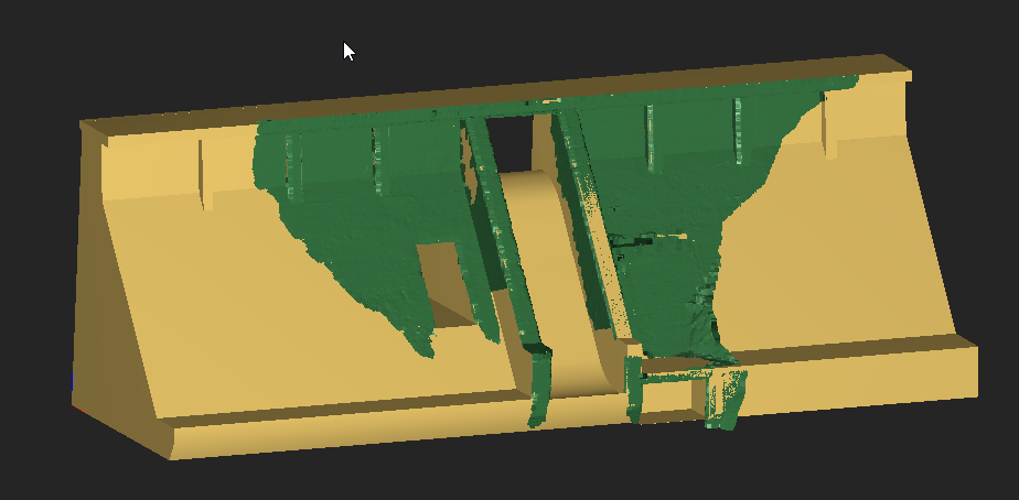 Cloud and mesh aligned with the best fit method