Exercise: Automatic creation of a Digital Terrain Model from a point cloud
Open a new project and import the file "ExtractGround.nsd".
You can directly drag and drop it in the 3D scene, or import it with the function Import. Be sure to set file unit to meter. It is the scan of a road going through a forest, so there is a large amount of vegetation to remove in order to keep only points on the ground.
Select the point cloud and launch the command DTM.
Set the maximum slope that can be seen in the terrain to 45°. Choose Z axis as the direction for the computation. The Extraction grid size will give you the level of details in the final mesh. This value is computed by default, but you can set it to 0.15 m.
Choose Check noisy points as extraction strategy.
Choose the Refined meshing strategy in order to improve the result.
Click Preview to get the resulting mesh. You can show or hide the initial cloud in order to better see the result.
It is also possible to extract the points that are on the ground, the points that are not on the ground or the noisy points. Click OK to create the mesh.
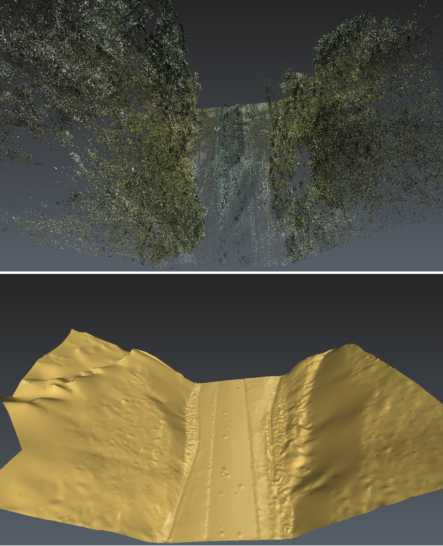 Automatic creation of a DTM