Managing units and UCS when importing/exporting
Import
Unit
It is asked to tell the unit of the imported data (most of the time, it cannot be read automatically). According to the current project unit, a scaling will be performed.
Example
A file storing data in meters imported in a project in centimeters: the point (1 m; 2 m; 3 m) becomes (100 cm; 200 cm; 300 cm).
If the file stores data at a wrong scale, the wrong scaling will be kept: use Resize to fix it.
Example: a file in meters storing data in centimeters imported in a project in centimeters. The point (100 m; 200 m; 300 m) but (100 cm; 200 cm; 300 cm) in your mind becomes (10000 cm; 20000 cm; 30000 cm).
If the current project is set in the wrong unit, the scaling will be performed correctly but you may read inappropriate dimensions: use Repair Project Unit to set the appropriate unit.
Example: a file in meters imported in a project in centimeters. The point (1 m; 2 m; 3 m) becomes (100 cm; 200 cm; 300 cm). Repair Project Unit updates (100 cm; 200 cm; 300 cm) to (1 m; 2 m; 3 m).
If a format stores unit (such as DXF, IGES or IFC), it is automatically read during the import. If the written unit is false, a wrong scaling will happen. Here, you can override the unit.
Example: a file, said in centimeters, storing data well dimension-ed in meters imported in a project in millimeters.
Using the unit from the file: the point (1 m; 2 m; 3 m) is read as (1 cm; 2 cm; 3 cm) thus is imported as (10 mm; 20 mm; 30 mm).
Using the forced unit: the point (1 m; 2 m; 3 m) is red (1 m; 2 m; 3 m) thus is imported (1000 mm; 2000 mm; 3000 mm).
UCS
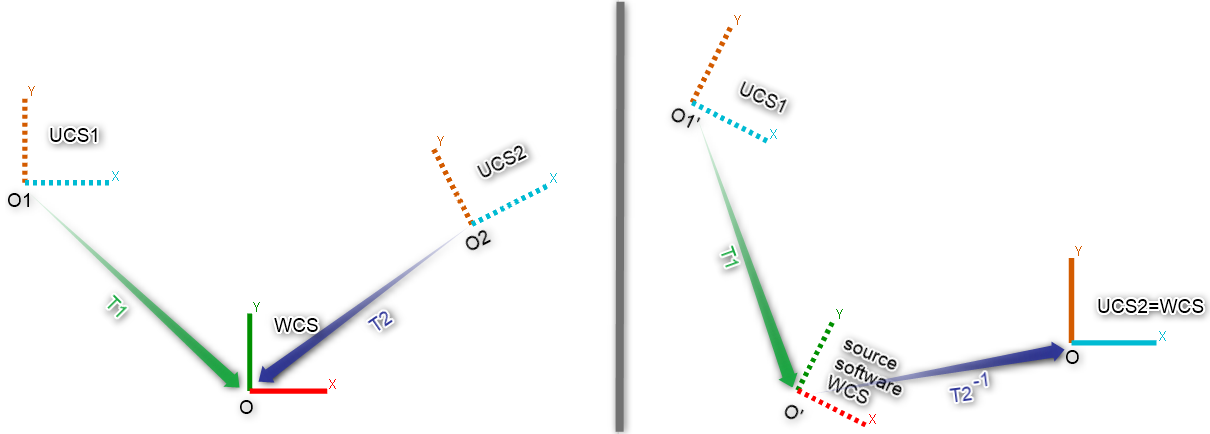
Some formats store User Coordinate Systems (such as LGS, IFC). A transformation, including translations and rotations, will be applied to define the object position according to the chosen UCS.
Example
Coordinates given in the UCS of the source project will match the coordinates of the 3DR project WCS.
 Source and target coordinate system: result when chosing UCS2
Export
Unit
It is asked to choose a unit to decide what numerical values to share. According to the current project unit and the target unit, a scaling will be performed.
Example
A project in meters exported to a file in centimeters: the point (1 m; 2 m; 3 m) becomes (100 cm; 200 cm; 300 cm).
UCS
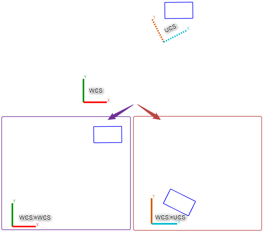
When a UCS is activated, it is possible to choose to export data given in this UCS (otherwise, the WCS will be used). Consequently, this UCS will act as a WCS in the exported file.
 UCS or WCS
Some formats don't use UCS; others can store several UCS like LGS.
Send to
Unit
No scaling applied to numerical values:
The point (1 m; 2 m, 3 m) from a project in meters becomes (1 in; 2 in, 3 in) in an AutoCAD document in inches.
The point (1 m; 2 m, 3 m) from an AutoCAD document in meters becomes (1 in; 2 in, 3 in) in a project in inches.
When using the Send To command, always make sure to work in the same unit in both applications.
Use Change Current Unit to fix the current project unit globally.
UCS
When a UCS is activated in the document, it is possible to choose to send the data given in this UCS (otherwise, the WCS will be used).
Sending data: data are always inserted using the receiver WCS.
Receiving data: data are inserted using the activated UCS.